Browse by Tags: america
 | Up a level |
Number of items: 3.
![[img]](http://www.humbox.ac.uk//664/1/PHI_00898_America.jpg)
 Preview |
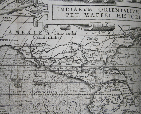
Early Maps: America by Givanni Maffei (1589)
Shared with the World by Dr Matt Phillpott
Map of America, part of a drawing of the world by the Italian Givanni Maffei. Published in 1589. Used for exploration and discovery. The original copy of this image can be found at the Roderic Bowen Library and Archives, University of Wales Lampeter.
Shared with the World by Dr Matt Phillpott
![[img]](http://www.humbox.ac.uk//698/1/ODS_01455-California.jpg)
 Preview |
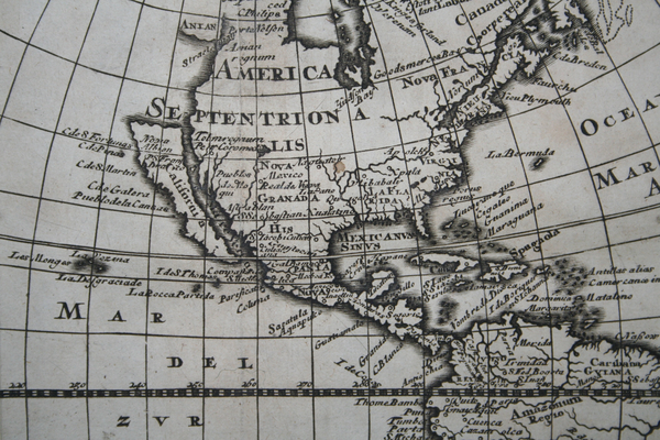
Early Maps: California, America (1676)
Shared with the World by Dr Matt Phillpott
Map of California (America) drawn in 1676. Used for description and travel. The original copy of this image can be found at the Roderic Bowen Library and Archives, University of Wales Lampeter.
Shared with the World by Dr Matt Phillpott
![[img]](http://www.humbox.ac.uk//659/1/PHI_03081-Tierra_Nueva.jpg)
 Preview |
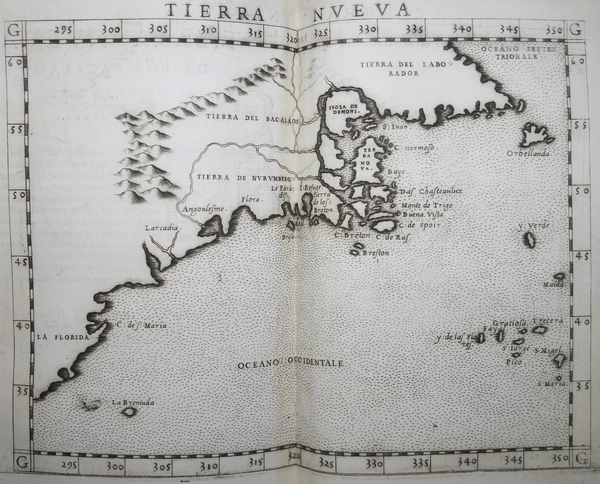
Early Maps: Tierra Nueva by Girolamo Ruscelli (1561)
Shared with the World by Dr Matt Phillpott
Map of Tierra Nueva (New England/The East coast of North America) drawn by the Italian Alchemist, physician and cartographer Girolamo Ruscelli in 1561. Based upon a 1548 map published in Giacomo Gastaldi's La Geografia. The original copy of this image can be found at the Roderic Bowen Library and Archives, University of Wales Lampeter.
Shared with the World by Dr Matt Phillpott


